
EV graduate student Nicole Mathews thesis proposal accepted by committee
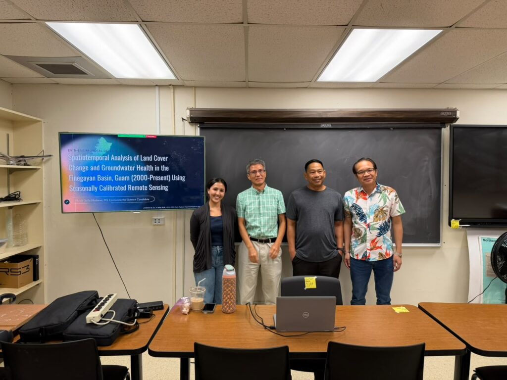
The Water and Environmental Research Institute of the Western Pacific (WERI) at the University of Guam proudly announces the successful thesis proposal defense of Ms. Nicole Celine Sulla Mathews. Mathews is a candidate for the Master of Science in Environmental Science. Her proposal defense took place on November 6, 2026, at the WERI Conference Room and virtually via Zoom.
Her thesis is titled “Spatiotemporal Analysis of Land Cover Change and Groundwater Health in the Finegayan Basin, Guam (2000-Present) Using Seasonally Calibrated Remote Sensing”. Mathews’s research is partially funded by the U.S. Geological Survey National Water Resource Institute 104(B) Program and the Guam Hydrological Survey. Her thesis committee is chaired by Dr. Yuming Wen, alongside committee members Dr. Jose Edgardo Aban and Dr. Nathan Habana.
Research Focus: Protecting the Northern Guam Lens Aquifer
Mathews’s research addresses critical water quality and land-use concerns regarding the Northern Guam Lens Aquifer (NGLA), which supplies approximately 90% of the island’s potable water. Her study focuses specifically on the Finegayan Basin, a highly susceptible recharge area that comprises only 7% of the NGLA’s total surface area but provides roughly 15% of the aquifer’s total production.
Recent data indicates that 62.5% of production wells within the Finegayan Basin show significant increasing trends in chloride concentrations, an indicator of saltwater intrusion or surface contamination. Mathews’s research investigates whether the rapid expansion of urban development and impervious surfaces—such as the ongoing construction at Marine Corps Base Camp Blaz—is directly correlated with these rising wellhead chloride levels.
Innovative Cloud-Resilient Mapping Methodology
Mapping land cover change in Guam is historically hampered by persistent tropical cloud cover and dynamic seasonal spectral shifts between the wet season (July to December) and the dry season (January to June). To overcome these challenges, Mathews has developed a specialized remote sensing workflow:
- Multi-Temporal Mosaics: Utilizing historical and current satellite imagery from Landsat 7, 8, and 9, Mathews constructs seasonal, cloud-free mosaics spanning from the early 2000s to the present.
- Two-Tiered Cloud Removal: The methodology uses Quality Assurance (QA) automated pixel mapping combined with manual polygon clipping to accurately remove clouds and shadows.
- Supervised Classification: The study employs a Support Vector Machine (SVM) algorithm calibrated to Guam’s specific seasonal vegetation and badland changes to accurately classify land types
Expected Deliverables and Impact
Once the land cover changes are mapped, Mathews will conduct spatial analyses using tiered buffer radii (ranging from 100m to 1000m) around selected production wells. By correlating the area of impervious cover within these buffers to historical mean chloride levels, this research aims to establish a direct statistical link between surface development and groundwater salinity in a karst aquifer.
Mathews is projected to defend her final thesis in April 2027 and graduate in May 2027. Her finalized workflow will provide WERI, the Guam Waterworks Authority (GWA), NAVFAC, and local policymakers with crucial, data-driven tools to update land-use policies and strengthen groundwater protection zones across the NGLA.
Read More
Latest News
Email
Print
WhatsApp
LinkedIn
Facebook
Twitter